Saldrá de acá el sistema que rompa el récord de 2005?
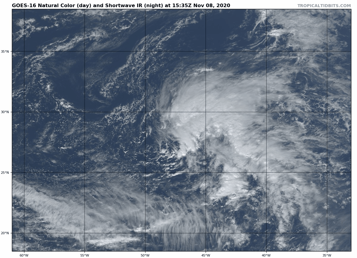
Recent satellite-derived wind data confirm that a low pressure
system has developed several hundred miles southwest of the Azores.
Shower and thunderstorm activity associated with this system is
currently disorganized. However, the low could slowly develop
tropical or subtropical characteristics during the next several days
while it moves eastward or east-northeastward over the northeastern
Atlantic Ocean. * Formation chance through 48 hours...low...10 percent.
* Formation chance through 5 days...low...30 percent.
Spoiler
Última edición por maatii96 el Mar Nov 10, 2020 4:33 pm, editado 2 veces en total.
A low pressure system is located several hundred miles southwest of
the Azores. Shower and thunderstorm activity associated with the
system is beginning to show some signs of organization. This low
could develop further over the next several days, and a tropical or
subtropical storm could develop by the end of the week while this
system moves eastward or east-northeastward over the northeastern
Atlantic Ocean. * Formation chance through 48 hours...low...30 percent.
* Formation chance through 5 days...medium...40 percent.
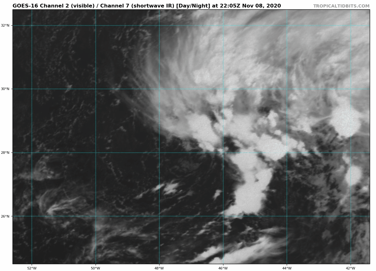
1. Shower activity associated with a non-tropical low pressure system
located several hundred miles southwest of the Azores is showing
some signs of organization. This system will likely gradually
acquire subtropical or tropical characteristics this week, and a
tropical or subtropical storm could develop within a few days while
this system moves eastward or east-northeastward over the
northeastern Atlantic Ocean. * Formation chance through 48 hours...medum...40 percent.
* Formation chance through 5 days...medium...60 percent.
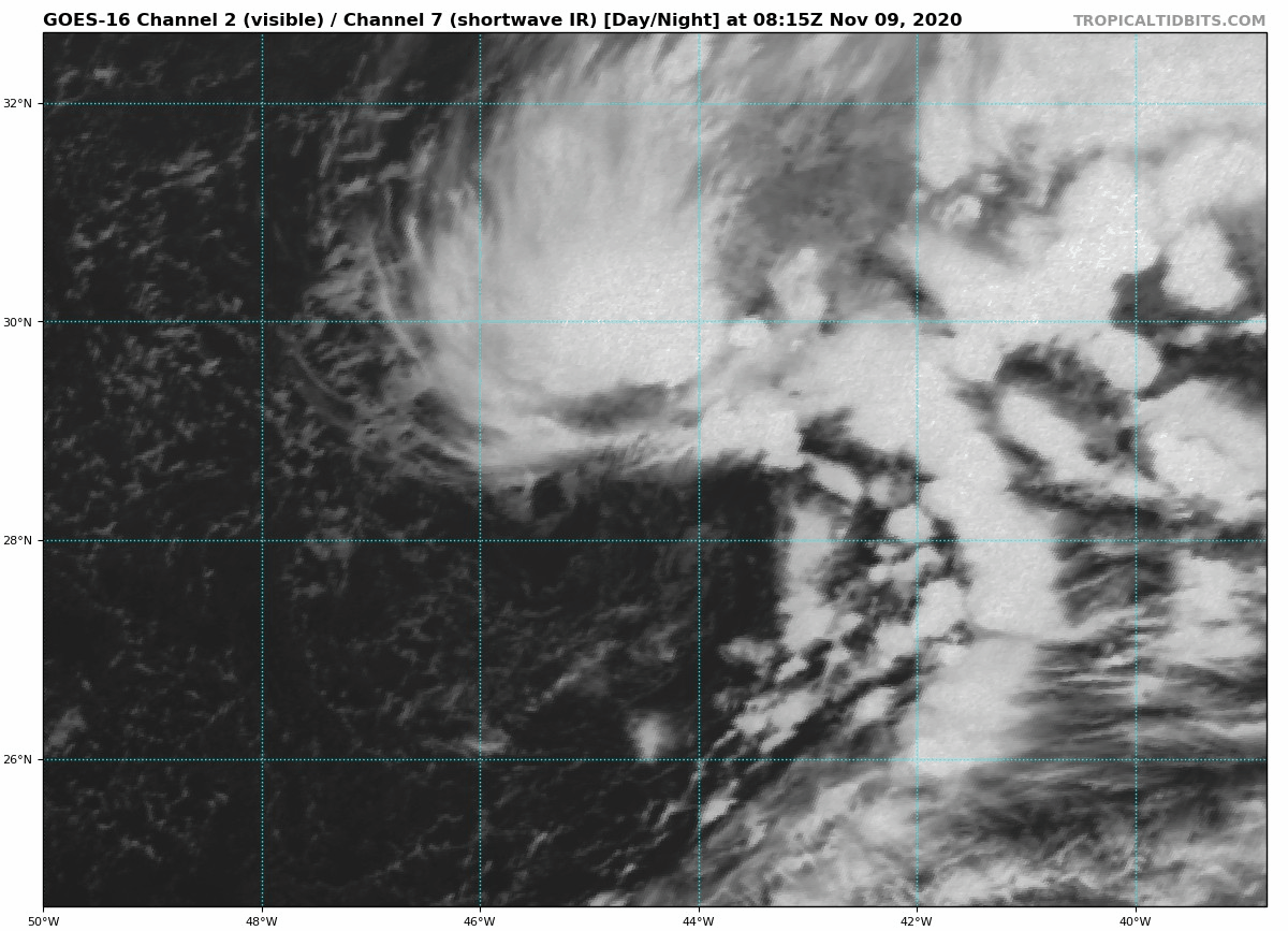
Showers and thunderstorms associated with a non-tropical low
pressure system located several hundred miles southwest of the
Azores continue to get gradually better organized. Further
development is expected, and a tropical or subtropical storm will
likely form during the next few days while the system moves eastward
or east-northeastward over the northeastern Atlantic Ocean. * Formation chance through 48 hours...medium...50 percent.
* Formation chance through 5 days...high...70 percent.
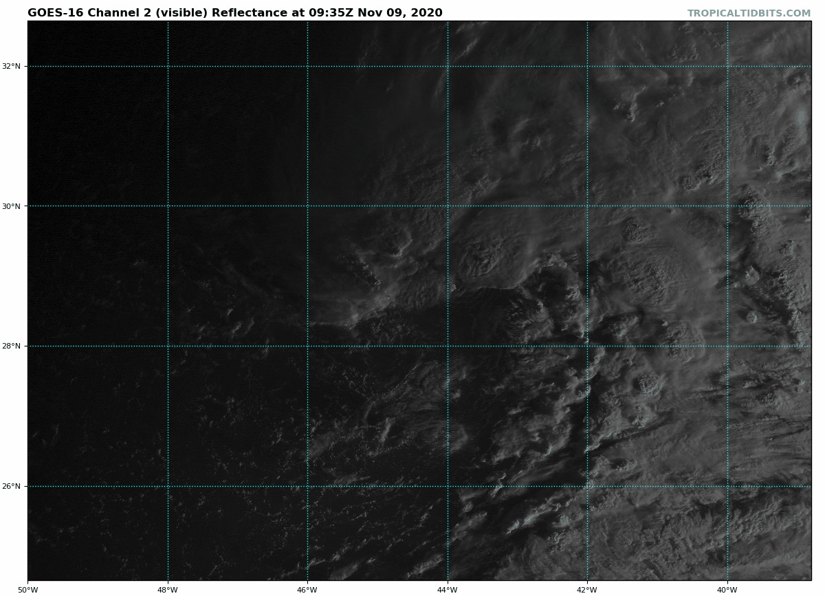
Shower and thunderstorm activity associated with a gale-force low
pressure system located several hundred miles southwest of the
Azores has become a little more concentrated near the center and
it appears to be becoming more distinct from the frontal boundary
located to the northeast of the system. If these trends continue, a
subtropical or tropical storm is likely to form tonight or Tuesday
while the system moves east or east-northeast over the northeastern
Atlantic Ocean. * Formation chance through 48 hours...high...80 percent.
* Formation chance through 5 days...high...90 percent.
Va a ser épica la próxima discusión del NHC, mencionando el récord histórico de la temporada más activa jamás dada en el atlántico (post 1850 o post HURDAT)
Nunca creí que iba a ser testigo de una temporada que supere a la del 2005. Increíble.
Tormenta nombrada número 29 de la temporada, récord absoluto.
...SUBTROPICAL STORM FORMS OVER THE OPEN NORTHEAST ATLANTIC... ...RECORD-BREAKING 29TH NAMED STORM OF THE SEASON...
SUMMARY OF 300 AM GMT...0300 UTC...INFORMATION
----------------------------------------------
LOCATION...28.8N 40.3W
ABOUT 995 MI...1600 KM SW OF THE AZORES MAXIMUM SUSTAINED WINDS...50 MPH...85 KM/H
PRESENT MOVEMENT...E OR 90 DEGREES AT 15 MPH...24 KM/H MINIMUM CENTRAL PRESSURE...1000 MB...29.53 INCHES
De la discusión:
Theta is the 29th named storm in the record-breaking 2020 Atlantic
Hurricane Season, breaking the previous record of 28th named storms
in 2005.