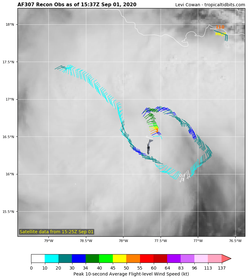
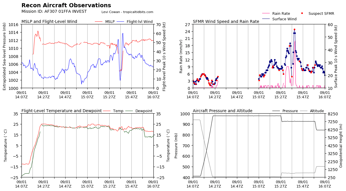
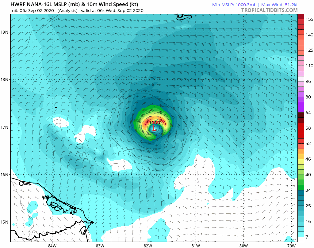
35 kt y 1005 hPa de momento. El recon soportaría una intensidad de 45 nudos.
Edit: Cuánto duró el nombre del topic? Veinte minutos?
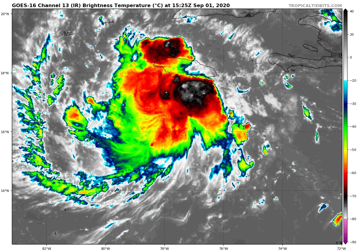
...POTENTIAL TROPICAL CYCLONE STRENGTHENS TO TROPICAL STORM NANA...
Air Force Reserve Hurricane Hunter aircraft data indicate that the
potential tropical cyclone has become Tropical Storm Nana. The
maximum winds are estimated to be 50 mph (85 km/h) with higher
gusts. A special advisory will be issued to update the forecast
within the hour.
SUMMARY OF 1205 PM AST...1605 UTC...INFORMATION
----------------------------------------------
LOCATION...16.5N 77.7W
ABOUT 120 MI...195 KM SW OF KINGSTON JAMAICA
MAXIMUM SUSTAINED WINDS...50 MPH...85 KM/H
PRESENT MOVEMENT...W OR 280 DEGREES AT 18 MPH...30 KM/H
MINIMUM CENTRAL PRESSURE...1004 MB...29.65 INCHES


